Tshletshy Creek - The best whitewater in Washington!?
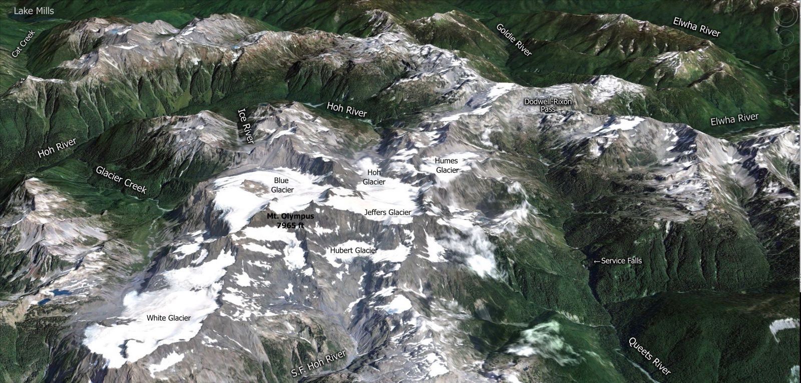
I have been looking at the description for Tshletshy Creek in the ‘Paddlers Guide to the Olympic Peninsula’ for 10 years now, wondering and dreaming if it really was what I had been imagining. That book by Gary Korb was one of many guidebooks that I kept around to scroll through when I wanted inspiration for new adventures and I was getting very intrigued by the Olympic Mountains! The Geology of the Olympics are unlike anything I had come across. Truly breathtaking! Looking down on 7,965ft Mt Olympus you can see rivers flowing out in all directions. Rivers such as the fabled Elwah and the mighty Queets flow down the mountains in spectacular fashion.
I tried to go a couple times that spring, but since summer arrived much later than expected I thought my window for getting in there was gone. Surprisingly Brett Barton sent a message that said, “Tshletshy next weekend?” After looking over the logistics again and understanding that we were still going to have to deal with 6 feet of snow at the top of the pass and the water level would be low but worthy of an exploratory trip, we made plans. To access Tshletshy you have to be ready for a long hike because you're hiking in from the NF of the Quinault drainage, over the low pass by Bear Creek gaining about 3,000ft in elevation, 6 miles up from the trail and dropping into the Tshletshy drainage which drains into the Queets river. It’s an adventure through the southwest portion of the Olympic Mountains.
Our plan – Hike in on Monday, boat on Tuesday, out on Wednesday, sounded good at the time. Luckily we planned for a couple extra days, just in case…
I tried hard to convince a couple paddlers to go, but in the end it was just Brett and I. The Tshletshy is a major undertaking. We met up on Sunday and decided to start hiking until dark. After about 4 miles and gaining about 1,400 feet in elevation we set up camp.
The next day we hiked up to the snow line, which started @ 2,800 feet, many hours later we hit the top of the low saddle pass at 3,608ft. Since the snow had covered the trail we had to follow the path of least resistance. This also led us into many gullies and around features that took up valuable daylight. Luckily the snow was pretty firm so we didn’t post-hole too many times and my Salamander Bak Yak made the hike much easier than my previous long distance hike-in’s.
Taking a pause at the snow covered Three Lakes, just before crossing the low saddle.
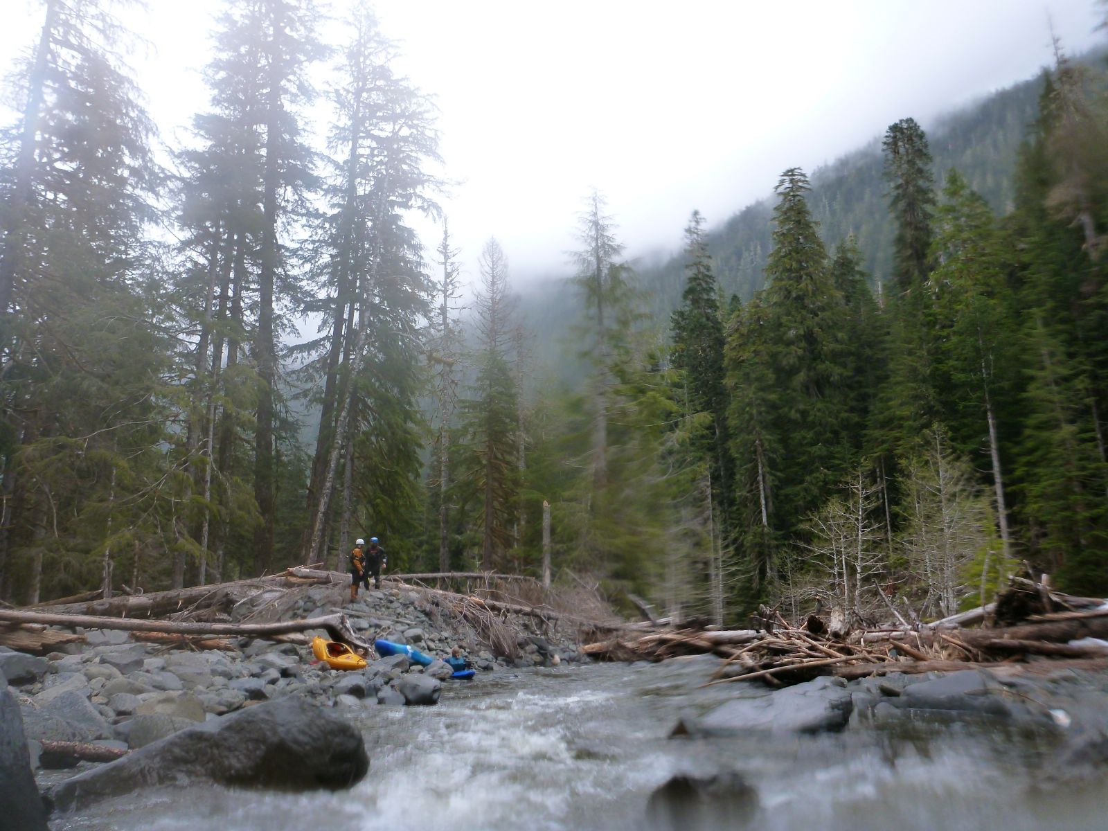
Starting the descent into the Tshletshy was very steep. We had a series of cliffs in front of us and we both had two 70’ Throw bags with us. Brett made his way down to the next place to stage boats, I tied my Salamander Throw Bags together and lowered the boats about a 100’ down to Brett. We did this a few more times and were finally on somewhat flat ground as we ran out of daylight and had to camp in a bare tree well surrounded by snow. The next morning we leisurely rolled out of camp while we listened to the elk calls from the hills above us. We had lost the trail the day before in the snow and were going off our maps and GPS to get us down to the put in. The trail down into the Tshletshy had been long abandoned making progress to the river a little harder.
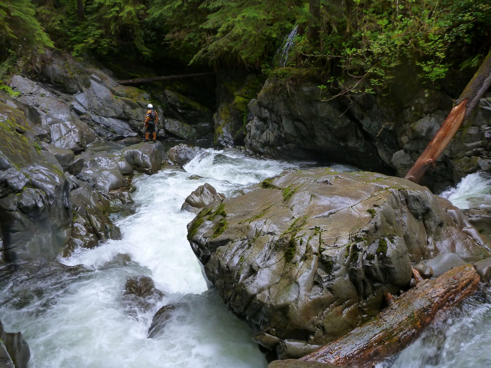
At the put in we had what looked like a low flow, but later in the trip it all evened out.. We paddled down to the first gorge with high hopes and found wood in the inner gorge blocking 4 of the 6 drops. We portaged on the right, crossed through the gorge and finished the portage on the left. The second gorge was a short series of class IV rapids that opened into a wide valley, there were many signs of massive flooding here from not long ago. Many of the tributaries in this section had blown out and sent old growth trees down the creek placing them in mid flow at the wider sections of Tshletshy.
After a few long portages over massive downed trees we set up camp early and rested for our next big day. Our Ultranighter Dry bags kept our sleeping bags and dry clothes dry for camp!
The open valley before the 3rd Gorge.
Day 4 – We reached the third gorge called “The Tshlasm” (3rd Gorge) within 20 min. out of camp. Here the creek dropped deeper and deeper into a gorge over a series of large waterfalls. We portaged on the right, continuing to look into the gorge as we hiked downstream, nothing looked runnable from the rim of the canyon.
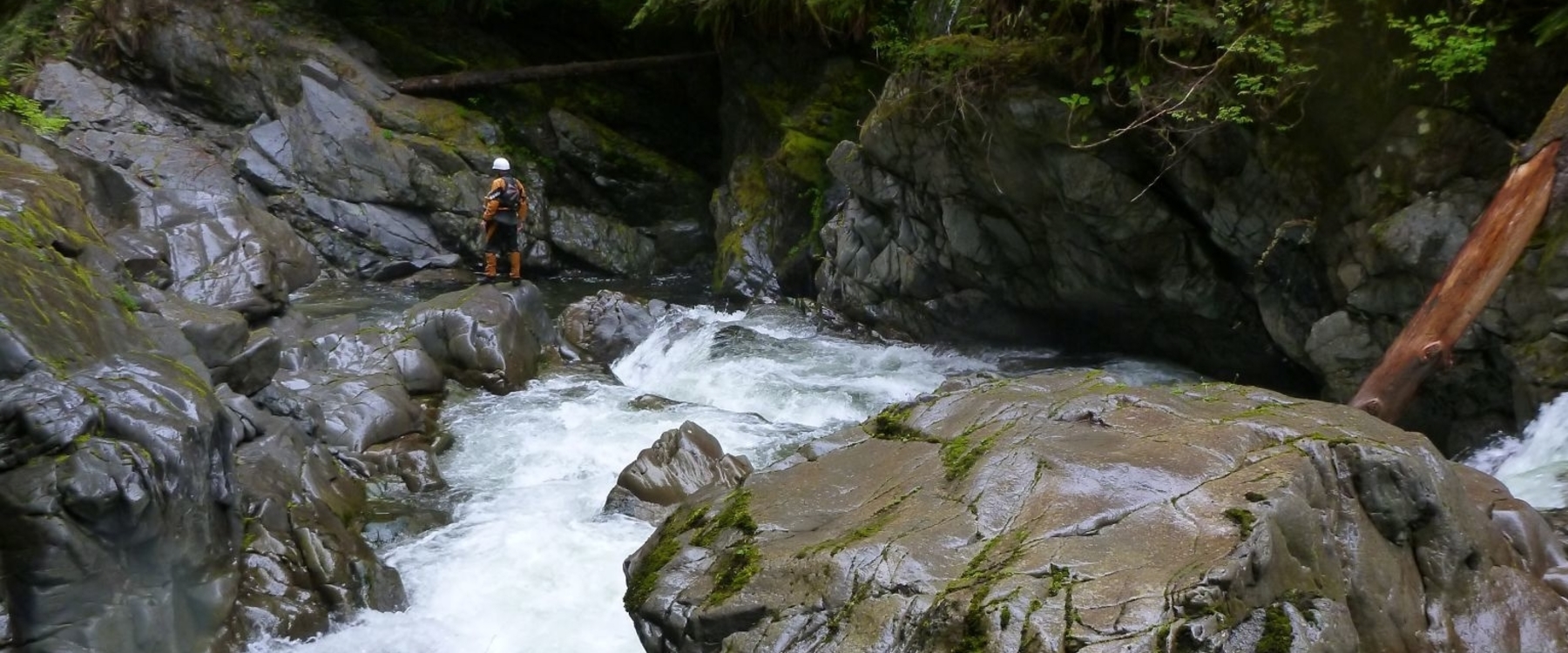
Just downstream we entered a very short mini gorge that ended with more wood portages. At this point I was beginning to wonder where the Best Whitewater in Washington was.. Soon we came around a corner to tight and tall canyon walls. The open valley and rocky beaches had given way to solid bedrock walls that seemed to grow the further we looked downstream. This is what we came for!
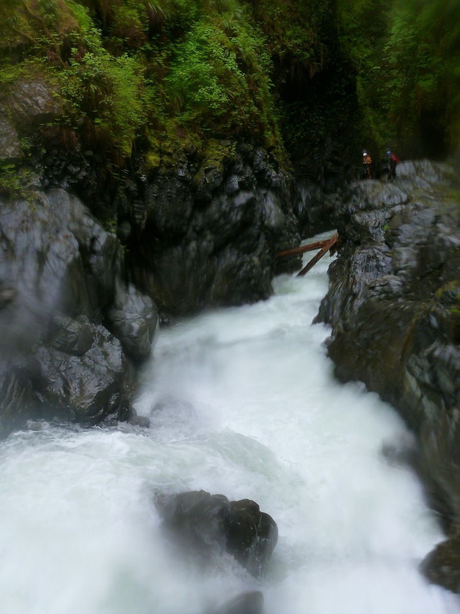
The scenery had officially changed, deep in the 5th canyon scouting the options.
Miles of read and run, class IV & V drops in an untouched pristine gorge. We saw many signs of wildlife, at one of the many times we had to get out and scout. I looked downstream and saw a massive Roosevelt Elk near water level. He disappeared the second he heard us. We even paddled by a bear cub down in the deeper part of the gorge.
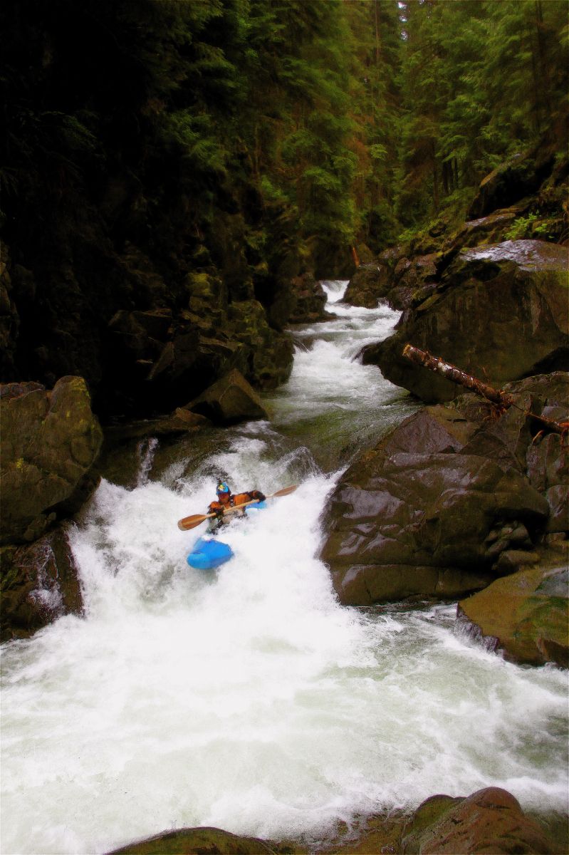

Brett enjoying the non stop action the the 5th gorge
Near the end of the 5th canyon we came to a rapid that had a tight pinch at the exit. The overhanging hour-glass shaped walls seemed to close off the canyon from our initial scout.
The beauty of the Tshletshy seemed to grow until suddenly the walls opened and we were drifting into the mighty Queets River. We reached the confluence with the Queets River at about dark and set up our last camp on a comfortable gravel bar. The next morning we woke up to light rain and paddled the remaining 7 miles of Class II out to the Sam’s River where the shuttle car was waiting.
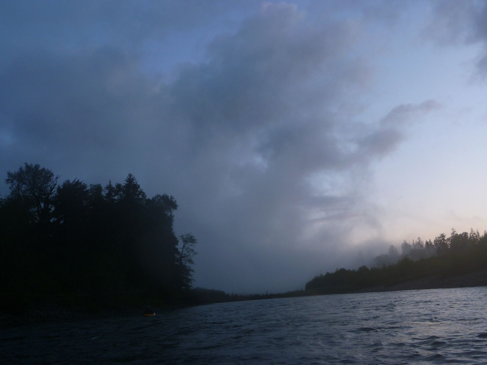
The mighty Queets River
All of the paddling reports that Brett and I had heard of were from 8-10 years ago. Either people had never heard of it or wanted to go check it out.. We went in knowing that there was a big wind storm in 2007 that downed many trees and littered many of the creeks in that area. As well as a couple major floods in the past 10 years. We had our fair share of portages in the flat rocky sections, over and under some of the largest trees I’ve seen in a drainage. In the end it was an amazing trip, which does hold some of the best whitewater in Washington, worth every bit of effort that went into it personally. The scenery is mind numbing and the overall experience is unforgettable! I would highly recommend a map and GPS for this trip, it helped us from walking too far in the wrong direction with a loaded boat a few times, since much of the upper trail was covered in snow. It made such an impression on both of us we went back again the next year.
Words; Ryan Scott
Photos; Brett Barton & Scott Baker
Comments